Showing posts with label san francisco neighborhoods. Show all posts

Friday, September 26, 2014

SF Building Boom and Beyond- Millennials Are So Smart


I recently attended a panel discussion San Francisco 
Building Boom and Beyond. I actually came away inspired. 
As much bad news as there is regarding changes in affordability 
and diversity in our fair city, the good news is that new development
is focused, (as many of us idealistic greenies visualized 30 years ago
when downtown's were dying) around transit and walkable 
communities. I commend the perseverance of planners (including 
SF's heavily burdened Planning Department) and placemakers, in 
the face of multiple very complex issues. 


sfstreetsblog

One part of this that I found so inspiring is that the buildings with .5
or less parking spaces per unit sold out quickly. and continue to do
so. I know part of this is that people just need any place to live in 
San Francisco these days, but peak US driving was in 2006, and 
Americans have been driving less since then, even in this booming 
economy. This next generation is less car centric and is flocking to 
places where "your apartment is your bedroom and your community 
is your living room".  Small spaces are hip and design creativity is 
making more them pleasant to live in.  Life with a smaller carbon 
footprint can be fun!
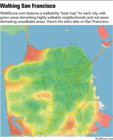


As a Realtor I drive a lot, so I know I am a little hypocritical 
advocating transit, cycling and walking.  My bicycle commute 
was one of the best aspects of my previous work. Driving here 
can feel like a stressful and complex video game these days, 
and I'm sure I'm growing new neural pathways as more and 
more bicycles and pedestrians are on the roads, but these 
trends are here to stay. Hallelujah I say!


sfstreetsblog transbay terminal


Off work I get out of the car as often as possible, and always feel 
better for it. Transportation here is reaching peak usage. Walkers 
and cyclists take a lot of pressure off of existing transportation 
systems. Transportation infrastructure is phenomenally expensive, 
so this is one of the bigger challenges facing us as a city, but policy
is in place and we are moving the right direction on a number of
fronts. 
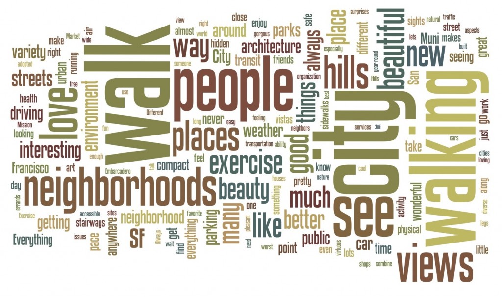


walksf.org


Call me a foolish optimist (I'm not the only one).  I know the 
problems we face are legion, and walk-ability, cycling and transit 
are not panaceas, but I feel more confident about the future as I 
watch the priorities of "kids these days" play out.


Happy Friday!


Wednesday, August 14, 2013

"Moving to San Francisco? This Map Will Tell You Where to Live"


Retiring Guy Aerial SF

I'm not sure how I missed this awesome post from Far Out City, it almost makes this whole blog obsolete. It is really worth a look. I'm a little stunned at how helpful a collection of information it is.

Stanford Digital Humanities

If you like that San Francisco map thing, this post from Stanford University Libraries is really cool too.

National Park Service

Smart creative people are mapping San Francisco in newly possible ways, and the old maps are so quickly available now in a Google image search. This guy is integrating old and new maps. The San Francisco Planning Department has a Map Library.  There are seemingly unlimited options for interesting SF mappish-ness. Fun!


Wednesday, August 24, 2011

Shake-y Shake-y

Standing on Shakey Ground


punkrockmichelle
All kidding aside, it seems like a good time to take a closer look at the Liquefaction map, and the Seismic Hazards Maps.  Prior to purchasing property here, you may want to look at the properties location on the hazard maps, to see if it is located in a liquefaction or landslide zone.  

geoIQ
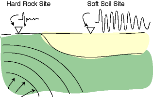
When the earth shakes, the underlying earth material is of differing degrees of "shake-ability". Bedrock is the most stable, though it varies depending what kind of bedrock, and mud and fill are the least stable.


Museumca.org
The liquefaction map looks very similar to creek and watershed maps, which is because much of the liquefaction area is fill, (old ships and garbage) placed in former creeks and wetlands. In these areas, the ground can turn from a solid to a liquid state when shaken, causing increased likelihood of buildings being shifted off their foundations or worse. 


mceK12


The golden gate hills offer up exposed bedrock, or a covering layer of less consolidated rock or soil, and often a mix of the two. The variable substrates can be subject to different types of landslides, which can be triggered by earthquakes, or by high levels of rainfall.


SLU


The extreme variations in damage and death tolls we see with earthquakes, often house by house, have to do with proximity to epicenters and variable substrates but also building codes, materials and practices. For example, Port au Prince Haiti was close to the 7.0 epicenter, with largely unreinforced masonry construction and an enormous death toll, while the recent 8.8 Chilean earthquake killed less than 1,000 people, due to the distance of the epicenter from major population centers, and to building codes.


America's North Shore Journal


Earthquake insurance is expensive and limited here in our earthquake prone locale.  We'll take a closer look at our local earthquake related real estate issues in Shake-y Shake-y Part 2...


USGS


in the meantime, you can check out this cool link to earthquakes round the world.


(Thanks to Judith Sheridan and Zoe Cooper-Caroselli for your insights)