Saturday, August 27, 2011

Extreme Weather and Real Estate


Inhabitat

Well, hurricanes seem to have supplanted earthquakes in urgency level for me, particularly since my daughter is in Brooklyn.  Thankfully, she is not living in an evacuation area.. Though I usually focus on the golden gate here, it's clear it's all one planet when it comes to weather and loved ones. Its also clear that real estate concerns seem pretty trivial when lives are in danger, so my prayers are with everyone encountering extremes of all kinds, all over this magnificent globe.

Tree Hugger

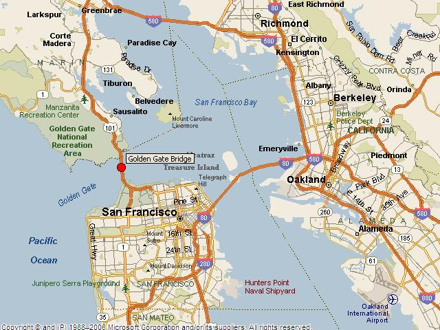
Meanwhile, in today's risk assessment for real estate (excellent distraction for a the worried Mom in me) we have more maps  (yay!) of San Francisco and Marin to identify potential danger zones for flooding, which is obviously very bad for property value and building health. Flooding here at the golden gate could be caused by a tsunami or by a severe winter storm and may be exacerbated by high tides/heavy rain/dam failure/pipe failure or any combination thereof.  When purchasing property in historically flooded areas, you'll want your inspectors to alert you to any residual damage or moisture that could continue to have negative impact on the building.


Museum CA

The good news is that to some extent one can predict areas of greater or lesser vulnerability to inundation, (hint: water flows downhill)  and though of course all bets are off in the big picture of climate change, still there are many areas of higher ground to consider in your real estate search. The tough trade-off  for so many of us who love the sea, is that property near the water comes with the possibility it will become property IN the water.


SF Dam Failure Inundation Zones

SF Tsunami Inundation Maps

Marin County Tsunami Inundation Maps

Tsunami Risk Zone (scroll down for the map)

FEMA Map tools This is a huge data set, and requires a fast internet connection, but you can make your local map and save it. Companies like JCP will put this, and some of the data above, in a disclosure package which the Listing agent will have to offer interested buyers, but if you are the kind who'd like to take a look before you formally inquire about a specific property, this can be worth the effort.


livescience


Wednesday, August 24, 2011

Shake-y Shake-y

Standing on Shakey Ground


punkrockmichelle
All kidding aside, it seems like a good time to take a closer look at the Liquefaction map, and the Seismic Hazards Maps.  Prior to purchasing property here, you may want to look at the properties location on the hazard maps, to see if it is located in a liquefaction or landslide zone.  

geoIQ
When the earth shakes, the underlying earth material is of differing degrees of "shake-ability". Bedrock is the most stable, though it varies depending what kind of bedrock, and mud and fill are the least stable.


Museumca.org
The liquefaction map looks very similar to creek and watershed maps, which is because much of the liquefaction area is fill, (old ships and garbage) placed in former creeks and wetlands. In these areas, the ground can turn from a solid to a liquid state when shaken, causing increased likelihood of buildings being shifted off their foundations or worse. 


mceK12


The golden gate hills offer up exposed bedrock, or a covering layer of less consolidated rock or soil, and often a mix of the two. The variable substrates can be subject to different types of landslides, which can be triggered by earthquakes, or by high levels of rainfall.


SLU


The extreme variations in damage and death tolls we see with earthquakes, often house by house, have to do with proximity to epicenters and variable substrates but also building codes, materials and practices. For example, Port au Prince Haiti was close to the 7.0 epicenter, with largely unreinforced masonry construction and an enormous death toll, while the recent 8.8 Chilean earthquake killed less than 1,000 people, due to the distance of the epicenter from major population centers, and to building codes.


America's North Shore Journal


Earthquake insurance is expensive and limited here in our earthquake prone locale.  We'll take a closer look at our local earthquake related real estate issues in Shake-y Shake-y Part 2...


USGS


in the meantime, you can check out this cool link to earthquakes round the world.


(Thanks to Judith Sheridan and Zoe Cooper-Caroselli for your insights)

Friday, August 19, 2011

Mappishness


Historic Bridges


Dear God I love maps. I have just realized that there is such a thing as a map nerd, and that it's possible I am one.


Unique Media


So many of the links in the column to the right are to maps, because I am obsessed with them, and also because if I were looking at real estate around the Golden Gate, I'd want to orient myself with as many different kinds of maps as I could get my hands on to help me determine my preferred location, before I purchase property.


Historic Maps Restored

Once I liked a specific property, I'd want to know if there is an old creek, or fill subject to liquifaction underneath it. I'd also be curious about multiple other relevant factors such as slope and topography, schools and grocery stores, restaurants and libraries, historic use, crime statistics etc etc etc. In this wonderful age of information there is likely to be a map detailing pretty much anything you want to know, at least about SF and Marin, given the number of technically savvy map nerds in the area.

USGS

I just came across (thanks, again, Curbed) this extremely cool crowd sourcing project, which reminded me of Rebecca Solnits premise that there is a temporal aspect to maps, and an infinite number of things to be mapped in both time and space.

San Francisco Public Library

Um, getting a little trippy here. I'll leave you to check out mappish links to the right, under Resources, More Resources and Parks and Wildlands, but beware of rabbit holes. "That's how it works. You say ‘hey, that's interesting,' and you start doing research online and suddenly its 4am" says John of the aforementioned crowd (map nerd) sourcing project.


Tuesday, August 9, 2011

All about Eves

While I have learned to love modern architecture, I do find the lack of eves in the current "Dwellian" version of "sustainable" architecture inexplicable. Can someone explain this to me? There must be something I am missing.

Homedesignlatest.com
My feeling is that it is a design conceit, that is not ultimately very practical for the health of the building, at least in this climate.

I used to strongly prefer historic architecture to modern, but over time have learned to open my mind, look more closely and observe buildings carefully in their context. I love the juxtapositions of new and old, particularly in the same building. I am prone to crushes on buildings and neighborhoods, and my first serious crush on a "modern" building was on a "William Wurster Masterpiece" that was on the market earlier this year.


SFARMLS

So beautiful. Filled with natural light, and oriented with its back to the wind, protecting and creating a lovely south facing indoor outdoor space. Also, it has eves.

In looking for photos to illustrate this pet peeve of mine, I have to admit there are many elegant new approaches to eves being incorporated. Whew. Just watch out for eve-less wonders built in the 70's and 80's and more recently. If you consider purchasing one, you'll want to be sure to have roof, siding and windows inspected to be sure the buildings envelope hasn't been breached to allow water intrusion. Without eves, flashing and roofing material integrity and maintenance become more critical. Water intrusion, especially behind stucco, can do very expensive damage to your expensive investment.

Flickrfotos.com
Now don't get me wrong, I enjoy Dwell and have appreciated Sam Grawes redesign (stay tuned for the next evolution), and especially the magazines coverage of "green" design development. I just get impatient when I see form overriding function, rather than evolving from it, and sometimes Dwell has joined in the glamorization of buildings that are nice to look at but do not provide intelligent shelter. Which is the opposite of sustainable, regardless of spin. I'll save my starhitect rant for another day.

I think my overall point here is that it's not about modern or historic, boxy or ornate, its about location, orientation and functional basics, like eves.

Thursday, August 4, 2011

Historic or Sustainable?

A wise friend, historic landscape architect and preservationist, once pointed out that sustainable and historic are often one and the same. This was rather an epiphany for me at the time, though it is kind of obvious when you think about it.

Earlier, more vernacular architecture was built with local materials (no carbon intensive trips around the world for your granite counter tops) and located in the more comfortable locations for living.  This often meant close to water, with shelter from wind and exposure to sun in cooler climates, and protection from sun and exposure to breezes in hotter climates.


Towerbooks

Hence the early settlement of North Beach and Mission Dolores. In Marin you find similar early development near water in the sheltered Ross Valley, in the "banana belt" in Sausalito etc. Old ranches are usually in the lee of hills near creeks, and of course the Ohlone chose choice spots to move to on a seasonal basis.  I sometimes long to emulate them this foggy summer.

SC Museum of Natural History

The more a homes location and orientation is adapted to the climate and topography, the less energy is required to keep its occupants comfortable. Things as simple as double hung windows for control of circulation of air, and deep eves for protection from sun and rain also mitigate energy costs significantly.


Marin County Library


As the more desirable spots were taken, with the rapid growth of SF and surrounding areas prompted by the  gold rush, homes were built across the landscape, heedless of slope and orientation, and that's a subject for another post.